The Viking Way – from the Humber to the Trent at Nottingham via Lincoln and the Grantham Canal
12th – 19th September 2018
If someone had asked me a while ago what I thought of Lincolnshire, I would have said, ‘Flat and dull’.
How wrong could I be!
We had flown over Lincolnshire in Zulu Foxtrot many times on our way north. It slowly dawned on me that I was looking down on some very pretty countryside. Nothing dramatic, just rolling farmland. Perfect for walking!
The Viking Way, launched in 1976, and the answer to my quest, stretches from the Humber to Lincoln and on to Oakham in Rutland, a walk of 147 miles.
My walking partner, Mike Luxmoore, and I decided to walk to Lincoln only, a five-day walk of 94 miles. I would then walk the Grantham Canal from Grantham to Nottingham, a two-day walk of 33 miles. And notch up another canal towards my 97!
Day 1 Barton on Humber to Barnetby Le Wold
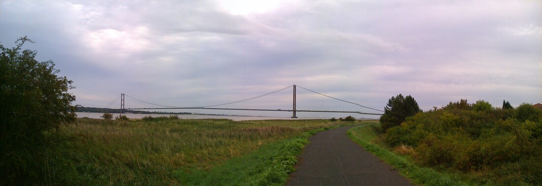
When opened in 1981 it had the longest span in the world and held that record for 17 years. End to end 1.4 miles long. The estuary, not a river, drains a fifth of England’s water!
7.30 Tuesday morning, we walked west, with our backs to the bridge and the estuary swirling and eddying beside us as the tide came in.
We’d walked out the evening before to stand at the centre of the bridge 30 metres above the murky churning waters below, with traffic hurtling behind us. We looked west into the setting sun across the vast expanse and imagined Viking warships heading up to the Ouse and Jorvik for some plunder and spoil! We did wonder why it had been built as it seems a bridge to nowhere but now a major tourist attraction and Grade 1 listed. Quicker than the ferry.
I don’t think many people walk this first section of the Viking Way. The waymarks were inconsistent and the notes were misleading. The A15, M180 and railway line were never far and cement factories dotted the landscape.
But we were walking down the Ermine Way, not a fur fetish but a corruption of the former tribe, Earninga. That was exciting in itself, to tread the footsteps of Roman centurions. Didn’t matter that we got lost and had to add three miles to our journey to find our beds for the night.
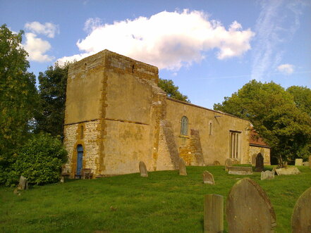
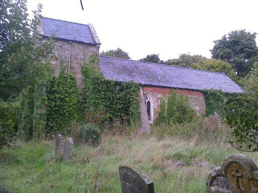
Barnetby Le Wold had three good things – the Flute and Whistle’s haddock chowder, fresh from the Hull fishermen, the Holcombe Guest House, welcoming, comfortable, with a bath, and St Mary’s Church, locked and abandoned in 1927 for a new church in the valley below.
We’d walked out the evening before to stand at the centre of the bridge 30 metres above the murky churning waters below, with traffic hurtling behind us. We looked west into the setting sun across the vast expanse and imagined Viking warships heading up to the Ouse and Jorvik for some plunder and spoil! We did wonder why it had been built as it seems a bridge to nowhere but now a major tourist attraction and Grade 1 listed. Quicker than the ferry.
I don’t think many people walk this first section of the Viking Way. The waymarks were inconsistent and the notes were misleading. The A15, M180 and railway line were never far and cement factories dotted the landscape.
But we were walking down the Ermine Way, not a fur fetish but a corruption of the former tribe, Earninga. That was exciting in itself, to tread the footsteps of Roman centurions. Didn’t matter that we got lost and had to add three miles to our journey to find our beds for the night.
Barnetby Le Wold had three good things – the Flute and Whistle’s haddock chowder, fresh from the Hull fishermen, the Holcombe Guest House, welcoming, comfortable, with a bath, and St Mary’s Church, locked and abandoned in 1927 for a new church in the valley below.
|
|
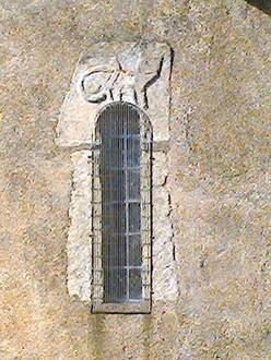
St Mary's Church, now locked and abandoned; Strange carving of a cat above a saxon window
We sat on the grave of Ann Williams with the sun on our backs and guessed the date – 11th, 12th, 13th? In fact, all three, we learnt later. Such a peaceful place for tired minds and weary feet.
The railway ran through the village to Immingham Port, UK’s largest port by tonnage, with the first docks opened in 1912 by King George V. Mike was to return this way, 5 days later, by train to collect his car from Barton on Humber – a journey all of forty minutes from Lincoln!!
I listened to the trains with their closed freight cars rumble by every 20 minutes and wondered what on earth they were carrying. Our rubbish, perhaps, to be dumped at sea. I later learnt 300 freight movements a week are made carrying dry bulk, forestry, liquids, general cargo and steel!
Day 2 Barnetby Le Wold to Tealby
Today we walked into the Wolds proper and it was enchanting. Village after village, all ending in ‘….by’*, and church after church, set in the folds of the escarpment, looking west over the Vale of the Ancholme River to the Pennines in the far distance. No wonder the Wolds are designated an ANOB.
Bigby, Somerby, Searby, Grasby, Clixby, Caistor, Nettleton, Normanby Le Wold, Walesby and Tealby, all mentioned in the Domesday Book. It’s truly a land of ancient settlements, saxon mounds, lost medieval villages, ruined abbeys and disused airfields. Humps and bumps in the landscape and huge stacks of straw deposited on the airfield hard standings. This is a land of echoes, of past times long gone, vestiges left on the land to be noticed or missed.
*Viking for village or settlement
The village of Clixby - just a few houses, and a church, All Hallows, with chancel only, redundant and forlorn, with dead blue tit and long tailed tit lying by the altar. We ate our marmalade sandwiches sitting in the sun where the nave once was.
We walked past Audleby, Fonaby and Hundon, all sites of vanished medieval villages, now farmsteads. In Caistor church lies the effigy of Sir William de Hundon, a crusader knight who died in the reign of Edward 1. Opposite the church is the grammar school, founded in 1631. As the name suggests, Caistor is the site of a roman fortress or castrum and boasts a piece of roman wall - well, you could have fooled me!! We bought our lunch in the Coop and moved on.
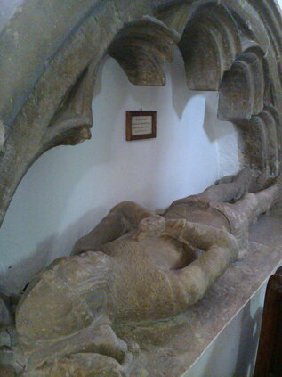
Sir William De Hundon, died 1270
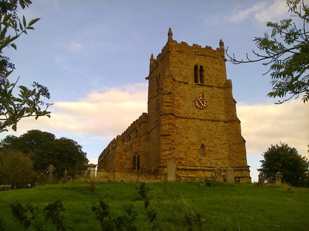
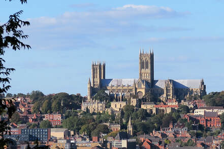
We walked up the Nettleton valley, watching the kites float on the wind, and reached the highest point at Normanby Le Wold, all of 550 feet. From there, we had our first sight of the towers of Lincoln Cathedral far away to the west.
|
|
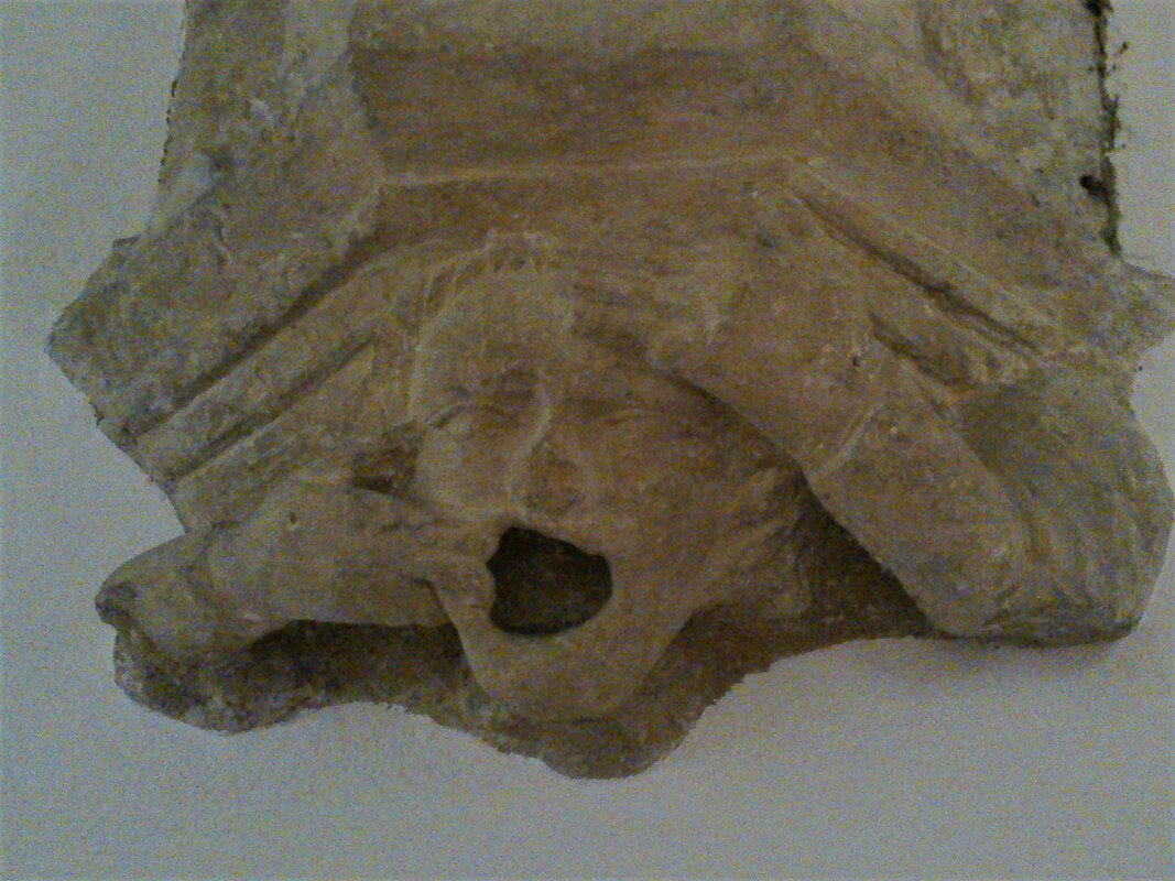
Church at Normanby Le Wold with its strange gargoyle(photo) and shepherds crook corbels; 'Oh my god, look, I've lost my teeth'!
We took a rest at Walesby church, known as the Ramblers Church. It has a stain glass window of Jesus with ramblers and cyclists! Another church to be abandoned by the village which moved off the escarpment to the valley below. The church is still occasionally used.
We reached Tealby in time for several whiskies and pints at the King’s Head waiting for our Woldview B&B hostess to come and lift us up Bully Hill. Thank God, it was very steep. They had to bully the horses to climb it. Hence its name.
Day 3 Tealby to Scamblesby
The Wolds have over 100 Lost Medieval Villages, several of which we were to pass today – West and East Wykeham, Calcethorpe, Biscathorpe, some unnamed, just humps and bumps in the land.
It also has the site of Bayons Manor just outside Tealby, home of Charles d’Eyncourt Tennyson, the uncle of Alfred, Lord Tennyson whose father was a rector in Somersby nearby and where Alfred grew up.
Charles inherited all the family wealth and built, in 1830s, his romantic ‘medieval’ castle with moats and drawbridges, turrets and towers. Sadly, Bayons Manor was a victim of the destruction of the country house post WW11 in the ‘50s and ‘60s, one of forty in Lincolnshire to be destroyed. Now just a heap of stones covered in trees and scrub and ‘keep out’ signs.
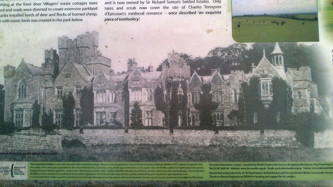
Described on the information board as 'an exquisite piece of tomfoolery'!
Charles also built the village hall and the school in Tealby and restored the church where Alfred’s brother was the rector before he went to Grasby. We had passed Grasby on Day 2 and admired the house where Alfred, staying with his brother, had composed some of his famous poems.
We walked over the high plateau, passing Grim’s Mound, and down into the valley of the River Bain, making Goulceby and the Three Horseshoes for lunch with minutes to spare!
We walked over the high plateau, passing Grim’s Mound, and down into the valley of the River Bain, making Goulceby and the Three Horseshoes for lunch with minutes to spare!
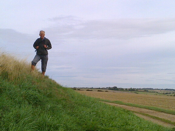
Grim's Mound, saxon, and Mike, not saxon.
Cultivated arable land makes up two- thirds of the Wolds
I walked on to Scamblesby via Asterby Church. The Paddocks B&B, near Cadwell Park, was very comfortable with bath, telly and supplies in the fridge. What more did I need, plus a pie left over from lunch. I shared the breakfast table with a racing family with a nervous young driver and his white shiny tourer ready to race that day at Cadwell.
Asterby Church in serious need of some TLC!
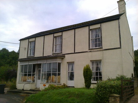
My night-time reading had been a book on Scamblesby as it had looked before WW11. As I walked through in the morning I could see none of that. All the old houses had been swept away for ‘60s bungalows. Apart from the church and a rather ghastly looking pub where I had hoped to have supper the night before, I found one other building, the old post office and shop, empty since 2004.
|
|
Scamblesby Post Office and Shop, closed in 2004. Sad!
Day 4 Scamblesby to Woodhall Spa
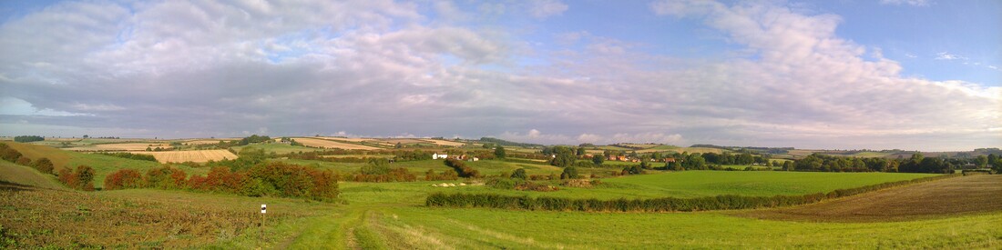
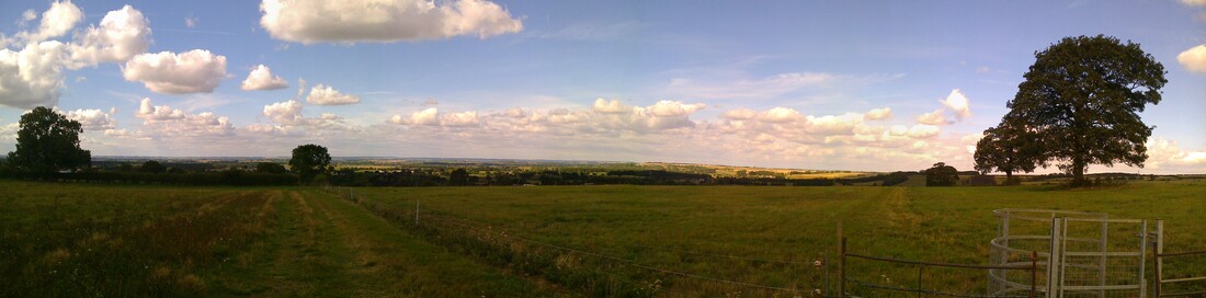
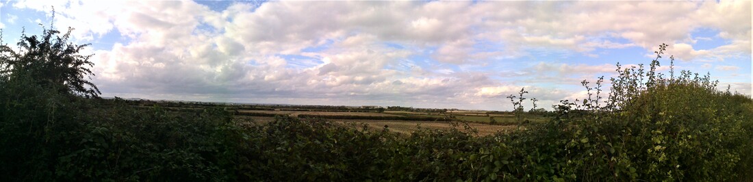
With views like this, who wouldn't want to walk! This is the valley from Scamblesby south over the hill to Bletchford and Fulletby. I met Mike who had stayed at Hemingsby, halfway.
It dawned on me that I was looking at a familiar landscape, so similar to where I had grown up in the Cotswolds in the ‘50s and ‘60s before royalisation and the influx of Brummites down the motorway. This is what it had been like – coombes and hills, church towers peeping above the trees, hidden manor houses sheltering in the folds, isolated farmsteads, rolling farmland, hedges and trees, valleys of cattle and sheep with streams, unspoilt market towns. Contentment by the acre, basking in early autumn sunshine.
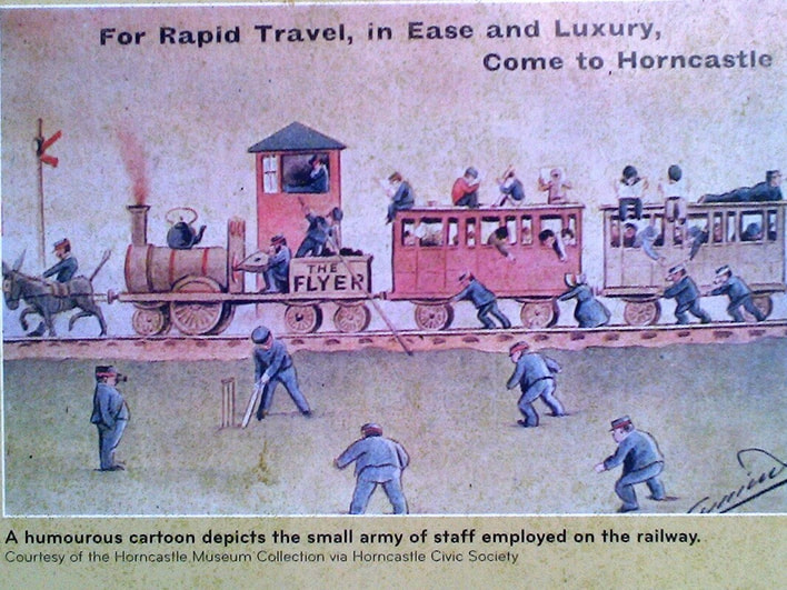
At Fulletby we literally walked off the Wolds down a long straight road, south to the fen country and Horncastle in the valley, another important Roman settlement and once home to the largest horse fair in England until 1948.
Bought fruit and carrots at the bustling market, nodded to the memorial to Edward Stanhope, a local MP and checked out Sir Joseph Banks’ town house. He grew up at Revesby Abbey just down the road. We met up with Alfred, Lord Tennyson again, who courted a young Horncastle girl, Emily Selwood, and checked out the imposing church and the Dymoke memorials, relations by marriage to Mike, and Knight Champions of England, from Scrivelsby Court nearby. And to my great joy, walked out along Horncastle canal, 9 miles, 11 locks, now disused, which links to the Witham River and the Wash. We then joined the disused railway line to head into Woodhall Spa.
Day 5 Woodhall Spa to Lincoln
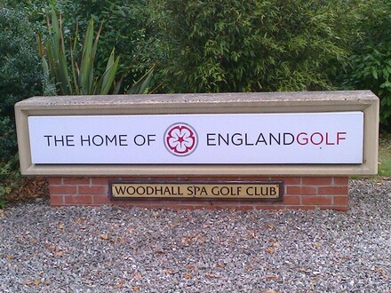
We had walked in over the golf course the day before, avoiding golfers and their balls as best we could! This is the Home of English Golf and the National Golf Centre, founded in 1905, and one of the world’s finest heathland golf experiences, according to the website.
We had walked in over the golf course the day before, avoiding golfers and their balls as best we could! This is the Home of English Golf and the National Golf Centre, founded in 1905, and one of the world’s finest heathland golf experiences, according to the website.
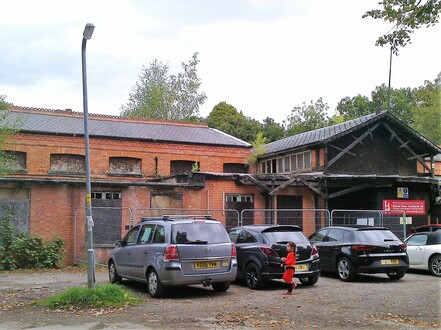
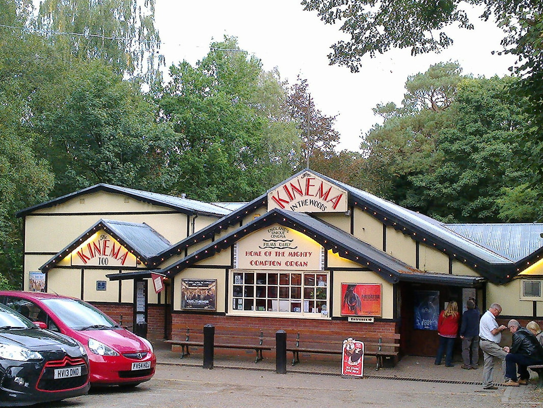
I’d never heard of Woodhall Spa but what a place! It was like walking onto a film set with no-one there to act. Buildings decked out in Victorian Tudor Revival Style, kings and queens for street names, Jubilee Gardens, disused railway station, pine woods, parades of shops, tea houses, little museums in tin huts and a Kinema in the Woods, Britain’s only rear projection cinema, known as ‘flicks in the sticks’ by the aircrews. It was enchanting.
In 1821, somebody dug a shaft looking for coal. Instead they hit a spring of saline water. Sick cattle drank and were cured so people followed suit. A bath house and hotel followed and in the late 19th century and early 20th it was the place to visit to take the waters, high in iodine and bromine.
In 1821, somebody dug a shaft looking for coal. Instead they hit a spring of saline water. Sick cattle drank and were cured so people followed suit. A bath house and hotel followed and in the late 19th century and early 20th it was the place to visit to take the waters, high in iodine and bromine.
|
|
|
|
Disused Spa Baths, Kinema in the Woods, Petwood Hotel, Dambusters Memorial
Sadly, the Spa Baths are no longer but, according to the Golf hotel where we were staying and which uses the waters in its own spa, attempts are being made to resurrect the Baths.
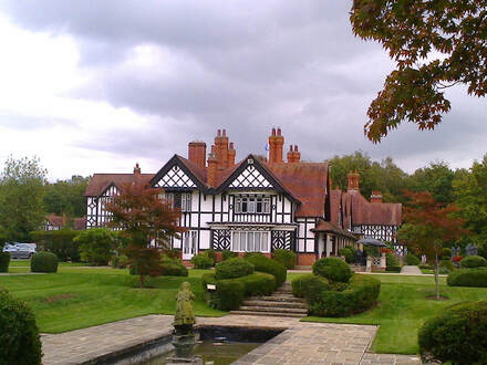
Petwood House was built for the daughter of Sir John Blundell Maple of Maple Furniture fame, a crazy creation of Edwardian splendour for entertaining on a grand scale. The Jaguar Club were visiting and celebrating 100 years of the RAF. How appropriate, in the building that housed the Officers’ Mess for the legendary 617 Dambusters Squadron and whose memorial sits in Royal Square Gardens.
Petwood House was built for the daughter of Sir John Blundell Maple of Maple Furniture fame, a crazy creation of Edwardian splendour for entertaining on a grand scale. The Jaguar Club were visiting and celebrating 100 years of the RAF. How appropriate, in the building that housed the Officers’ Mess for the legendary 617 Dambusters Squadron and whose memorial sits in Royal Square Gardens.
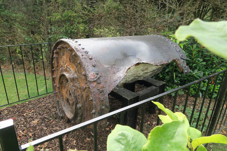
One of the few remaining prototypes of the Barnes Wallis' famous bouncing bomb in the gardens of the Petwood Hotel
They call it ‘Bomber County’, home to No.1 Group and No.5 Group of Bomber Command in WWII, with 49 airfields, more than any other county in England. We had already passed several. Estimates put the number of servicemen in and around Woodhall Spa at between 4,500 and 5,000. Now little remains of the airfield to the south east.
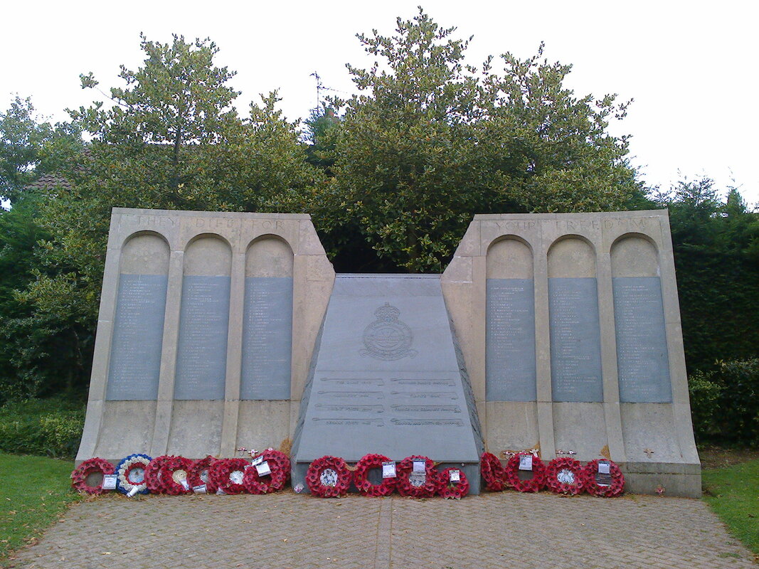
I was later to visit International Bomber Command Centre, just to the south of Lincoln. This remarkable memorial commemorates 58,000 men and women who died in WWII and 62 nations who served or supported Bomber Command. Native trees planted in the Peace Garden commemorate each Bomber Command station.
I was later to visit International Bomber Command Centre, just to the south of Lincoln. This remarkable memorial commemorates 58,000 men and women who died in WWII and 62 nations who served or supported Bomber Command. Native trees planted in the Peace Garden commemorate each Bomber Command station.
|
|
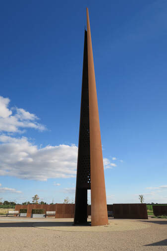
The Spire, 102 ft, equal to the wingspan of a Lancaster bomber Lincoln Cathedral across the valley from Centre;
Wall of Names: 58,000 men and women
Wall of Names: 58,000 men and women
The walk into Lincoln was 20 miles across country and along the River Witham. The towers of Lincoln seemed an awful long way away!! We arrived for Evensong just as they were all pouring out, the Great and the Good of the RAF, adorned with medals and walking sticks. We had half an hour before the cathedral closed.
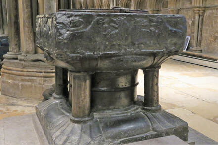
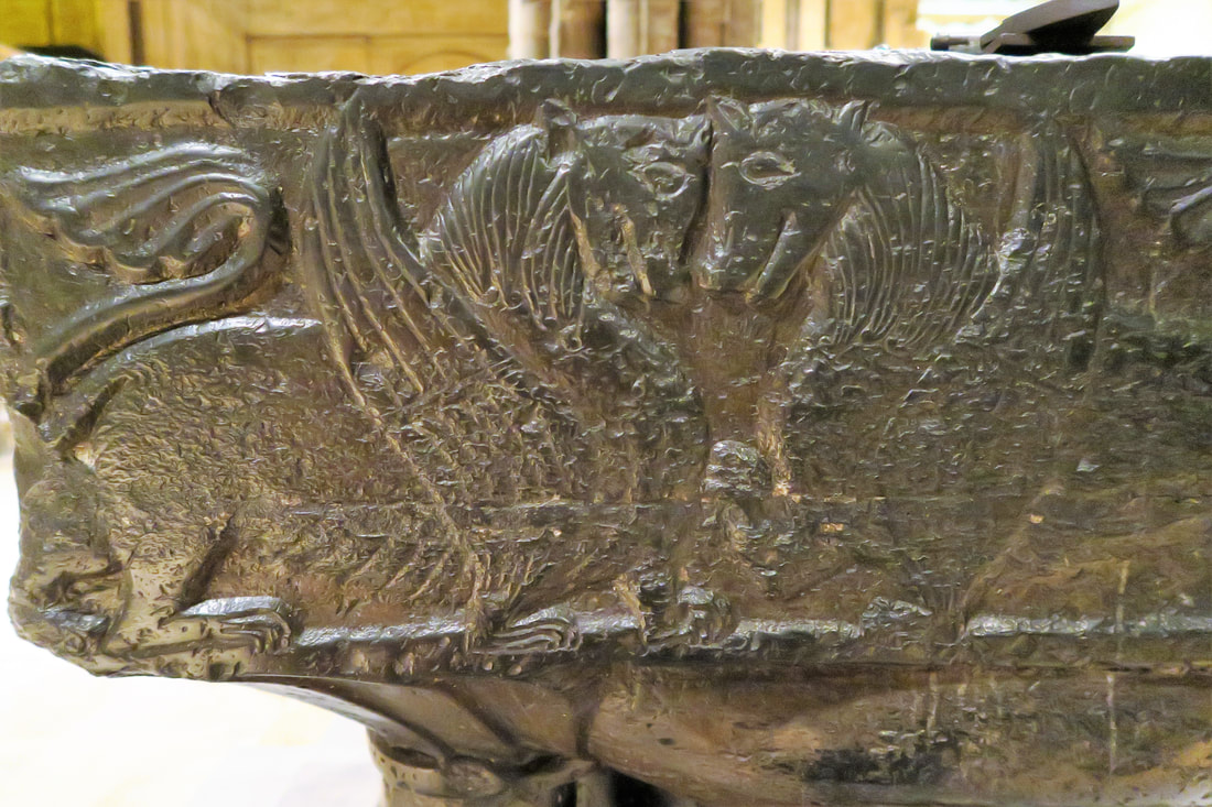
I went to morning prayers at 7.30 the next day and had a good hour on my own to look around afterwards. What an awe-inspiring place, so so special – the Tournai font in blue-black limestone, the Angel Choir with its 28 carved angels, the tombs of St Hugh, Eleanor of Castile and Katherine Swynford, wife of John of Gaunt, the medieval chalice in the Cathedral Treasury, the Father Willis organ, the military Services' chapels, Dean’s Eye stainglass window of 1220, the Chapter House with its central column and the Lincoln Imp, to name but a few of the delights.
I went to morning prayers at 7.30 the next day and had a good hour on my own to look around afterwards. What an awe-inspiring place, so so special – the Tournai font in blue-black limestone, the Angel Choir with its 28 carved angels, the tombs of St Hugh, Eleanor of Castile and Katherine Swynford, wife of John of Gaunt, the medieval chalice in the Cathedral Treasury, the Father Willis organ, the military Services' chapels, Dean’s Eye stainglass window of 1220, the Chapter House with its central column and the Lincoln Imp, to name but a few of the delights.
|
|
1 of 7 complete examples in England, carved in and around Tournai, in Belgium, in 12th c. and early 13th c.
I had heard the peregrine screaming from my hotel room and I saw him perched high up on the central tower, the tower with ts red light that brought the pilots home and from which they took a bearing to reach their airfields.
I had no idea that Lincoln sat on such a steep hill which is the southern edge of the Jurassic limestone escarpment, known as Lincoln Cliff, running 50 miles due north along the Trent valley to the Humber. No wonder William the Conqueror chose this place for his northern castle, begun in 1068, and sent Bishop Remigius to build a cathedral in 1072.
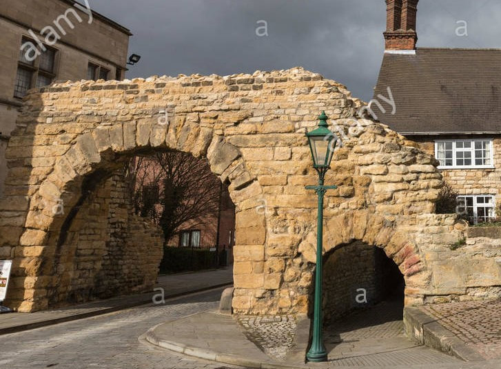
Lincoln is full of surprises – fourth copy of the Domesday Book in the castle, a fascinating collection of local archaeology in the Usher Gallery, beautiful buildings, particularly Minster Yard and the Bishop’s Palace, roman ruins including a roman gateway still in use by traffic in the 21st century, medieval shops and houses, Brayford Pool, a natural lake used by the Romans as a port and now the site of Lincoln University, with its large population of mute swans, and much more.
I had no idea that Lincoln sat on such a steep hill which is the southern edge of the Jurassic limestone escarpment, known as Lincoln Cliff, running 50 miles due north along the Trent valley to the Humber. No wonder William the Conqueror chose this place for his northern castle, begun in 1068, and sent Bishop Remigius to build a cathedral in 1072.
Lincoln is full of surprises – fourth copy of the Domesday Book in the castle, a fascinating collection of local archaeology in the Usher Gallery, beautiful buildings, particularly Minster Yard and the Bishop’s Palace, roman ruins including a roman gateway still in use by traffic in the 21st century, medieval shops and houses, Brayford Pool, a natural lake used by the Romans as a port and now the site of Lincoln University, with its large population of mute swans, and much more.
|
|
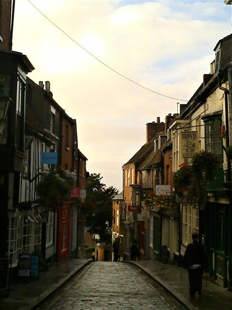
Steep Hill, aptly named, runs south from the cathedral to the new town; Newport Arch, Roman and still used by traffic!
|
|
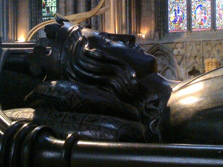
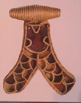
Eleanor of Castile who died in Lincoln 5th c. .Anglo-Saxon pendant found at Horncastle
Day 6 Lincoln to Grantham
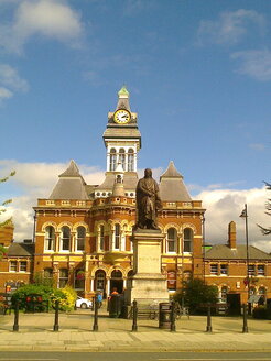
I rattled and bumped my way to Grantham through the villages on the local bus, badly in need of some new springs, and fetched up at the Angel and Royal, a hostelry on the Great North Road for the last 800 years. Put that in your pipe and smoke it!!
It was supposed to be a non-walking day but I still managed to walk 7 miles up and down that very long High Street in search of tourist information, hotel, church, post office, pizza express!
I met King Richard III again. This time alive and signing the death warrant of his cousin, the Duke of Buckingham, in 1480, in the King’s Room of the Angel and Royal. Also, Sir Isaac Newton who went to school in Grantham. What is it about this part of the country that gives birth to all these Greats. Is it something in the eastern air that sharpens the brain?
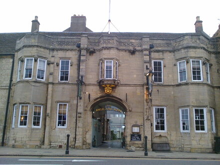
The Angel and Royal Hotel
|
Sir Isaac Newton outside Grantham Town Hall
|
Days 7 & 8 Grantham to Nottingham along the Grantham Canal
Vale of Belvoir
The canal closed to boating in 1929 but, since the 1970s, the Grantham Canal Restoration Society is slowly restoring it. It is going to be a long haul. Most of the canal, particularly at the western end, is not navigable. In fact, in parts I was able to walk along the bed of the canal through a forest of willows! This makes for a wonderful haven for wild life – no boats, no people, no disturbance.
So guess what I saw? A mother otter and her two cubs. They swam past me, giving me the once over and hurrying on, chittering away to each other. I was so bowled over I completely fumbled my phone and failed to take any meaningful shot. Just a vague blob in amongst the duckweed!!
I met a man soon after with binos round his neck so I asked him what he was looking out for. ‘Anything’ was his reply. I told him about the otters and he was amazed. They are so shy and aren’t normally seen in the day. How lucky was I! I’d seen heron so there was plenty of fish about.
The tow path, I’m glad to say, has been completely restored. Part of it is a SSSI with a grass path instead of stone which makes for fabulous walking. I was amazed how deserted it was. Just the occasional dog walker near villages and the odd group of fisherfolk. As I walked due west into Storm Ali, with the trees dropping their branches all around me, I was very aware how deserted it was.
The canal passes through the Vale of Belvoir, good flat hunting country, with hardly a road to be seen. It took me about 3 hours to walk round Belvoir Castle which was a constant on my left. The canal takes a huge loop north. No doubt some former Duke of Rutland said, ‘You’re not putting that thing through my land.’!
It also passes through Stilton Country and many a field of fat happy cows. I stayed the night at Long Clawson, home to one of the six dairies who are certified to make Stilton Cheese. Four of these dairies are in the Vale of Belvoir. Unfortunately the Crown and Plough, my bed for the night, had none. A great disappointment.
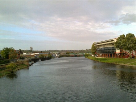
The next day found me standing on Trent Bridge, having battled my way through Storm Ali. THE Trent Bridge, I suddenly realised. And there was the cricket ground, a stone’s throw away. The Nottingham Canal took me to the railway station and my train back to London.
The canal closed to boating in 1929 but, since the 1970s, the Grantham Canal Restoration Society is slowly restoring it. It is going to be a long haul. Most of the canal, particularly at the western end, is not navigable. In fact, in parts I was able to walk along the bed of the canal through a forest of willows! This makes for a wonderful haven for wild life – no boats, no people, no disturbance.
So guess what I saw? A mother otter and her two cubs. They swam past me, giving me the once over and hurrying on, chittering away to each other. I was so bowled over I completely fumbled my phone and failed to take any meaningful shot. Just a vague blob in amongst the duckweed!!
I met a man soon after with binos round his neck so I asked him what he was looking out for. ‘Anything’ was his reply. I told him about the otters and he was amazed. They are so shy and aren’t normally seen in the day. How lucky was I! I’d seen heron so there was plenty of fish about.
The tow path, I’m glad to say, has been completely restored. Part of it is a SSSI with a grass path instead of stone which makes for fabulous walking. I was amazed how deserted it was. Just the occasional dog walker near villages and the odd group of fisherfolk. As I walked due west into Storm Ali, with the trees dropping their branches all around me, I was very aware how deserted it was.
The canal passes through the Vale of Belvoir, good flat hunting country, with hardly a road to be seen. It took me about 3 hours to walk round Belvoir Castle which was a constant on my left. The canal takes a huge loop north. No doubt some former Duke of Rutland said, ‘You’re not putting that thing through my land.’!
It also passes through Stilton Country and many a field of fat happy cows. I stayed the night at Long Clawson, home to one of the six dairies who are certified to make Stilton Cheese. Four of these dairies are in the Vale of Belvoir. Unfortunately the Crown and Plough, my bed for the night, had none. A great disappointment.
The next day found me standing on Trent Bridge, having battled my way through Storm Ali. THE Trent Bridge, I suddenly realised. And there was the cricket ground, a stone’s throw away. The Nottingham Canal took me to the railway station and my train back to London.
|
|
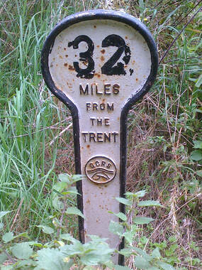
Standing on Trent Bridge! 32 miles from Grantham to Nottingham